An upper level low off the coast of Canada will be responsible for giving much of the region mostly clear conditions through much of this weekend, but at the same time, will also set the stage for some severe weather potential as we head into the day on Sunday.
Tomorrow looks to be a fantastic day outside if you're north of the Pennsylvania Turnpike as skies will be mostly clear with temperatures hovering in the upper 70s and 80s from Southeastern Pennsylvania up into Maine. Though it will be predominantly clear, northwesterly flow (via the ULL) will not only promote these clear conditions, but could also spark a stray shower or two in the area towards the evening, but this chance appears to be very isolated.
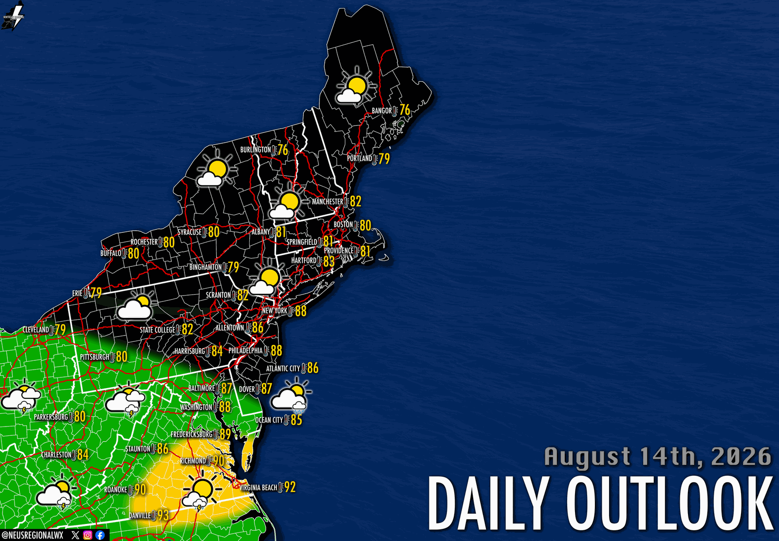
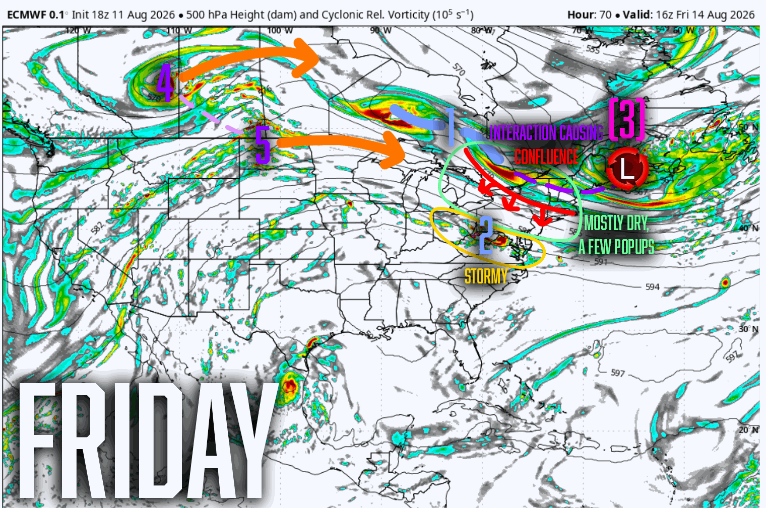
For areas south of the Pennsylvania Turnpike, confluence from the ULL will suppress and concentrate energy from a remnant MCS towards Maryland, Virginia, & West Virginia, promoting stormier skies as energy tugs through the area, especially in the afternoon & evening hours. Favorable thermodynamics across Southeastern Virginia, particularly the Richmond, Virginia Beach, and Norfolk areas, could promote a few severe thunderstorms Friday afternoon & evening, with the primary concern being damaging wind gusts and frequent cloud-to-ground lightning.
The energy moves out in time for our Saturday, which will feature mostly clear skies across the entire region, outside of some scattered, showery activity in the afternoon south of Pennsylvania. Temperatures will once again hover in the 80s. However, as we get into Sunday, storm chances increase as a low pressure system emerges out of Michigan.
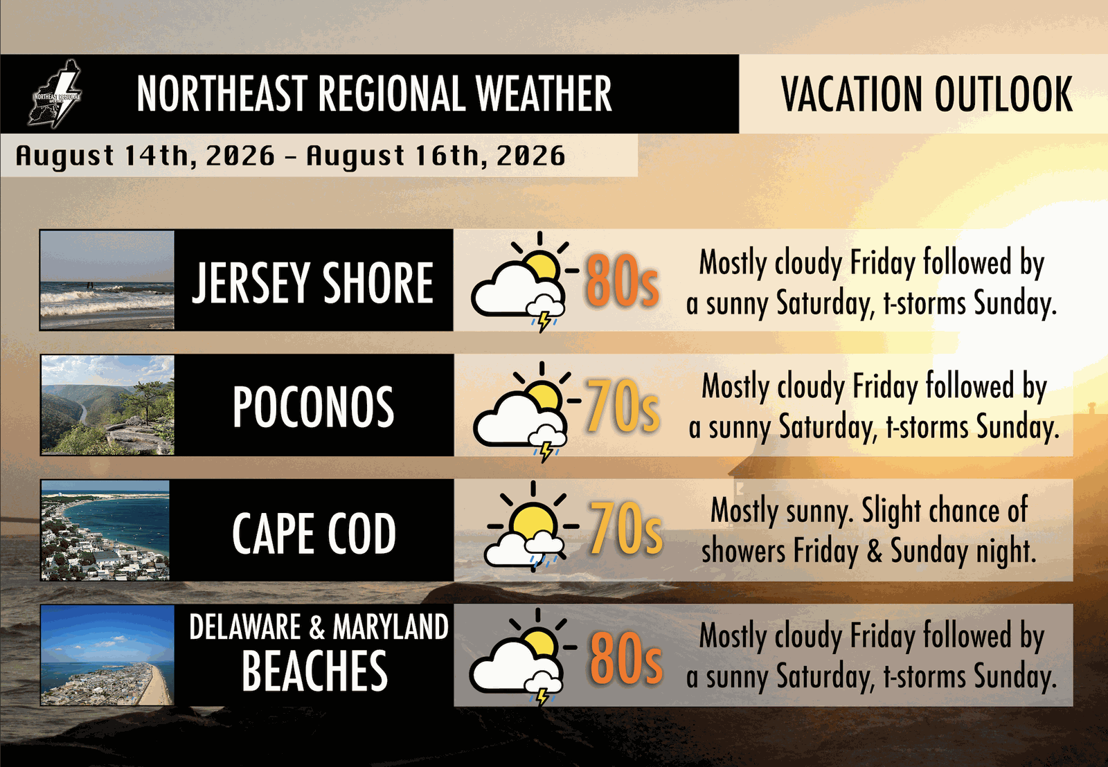
The upper level pattern responsible for the clear weather for the first half of this weekend is responsible for opening the door for the re-introduction of severe weather chances as far north and east as the Lehigh Valley in Eastern Pennsylvania. This could change throughout this weekend, as the timing of the system is still a little unclear, but areas best favored for severe weather remain across Western Pennsylvania, particularly the Pittsburgh area, Eastern Ohio, and West Virginia.
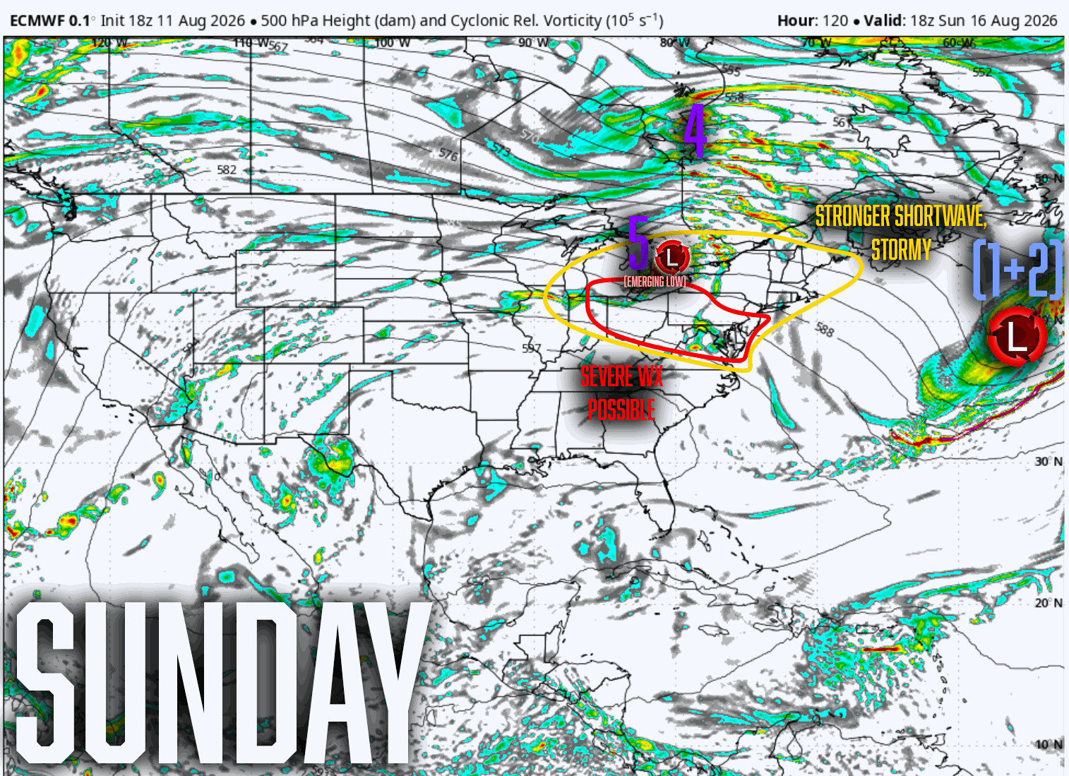
Details are rather unclear of overall storm mode, but given the thermodynamic environment at hand, all hazards will be possible, especially with much of the area being in the warm sector south and west of New York City.