Details are becoming much clearer regarding tomorrow's weather setup as an upper level low pressure system makes its way into the region, bringing heavy rainfall and thunderstorms area wide. Let's take a look at the latest information.
Our disturbance will move into the region overnight Monday into early Tuesday morning around sunrise. Associated with it will be intermittent showers and periods of rain. The combination of dew points in the upper 60s and lower 70s and precipitable water values exceeding 2" across the Upper Mid-Atlantic will allow for these showers to become more widespread in nature heading into the afternoon, with heavy thunderstorms developing.
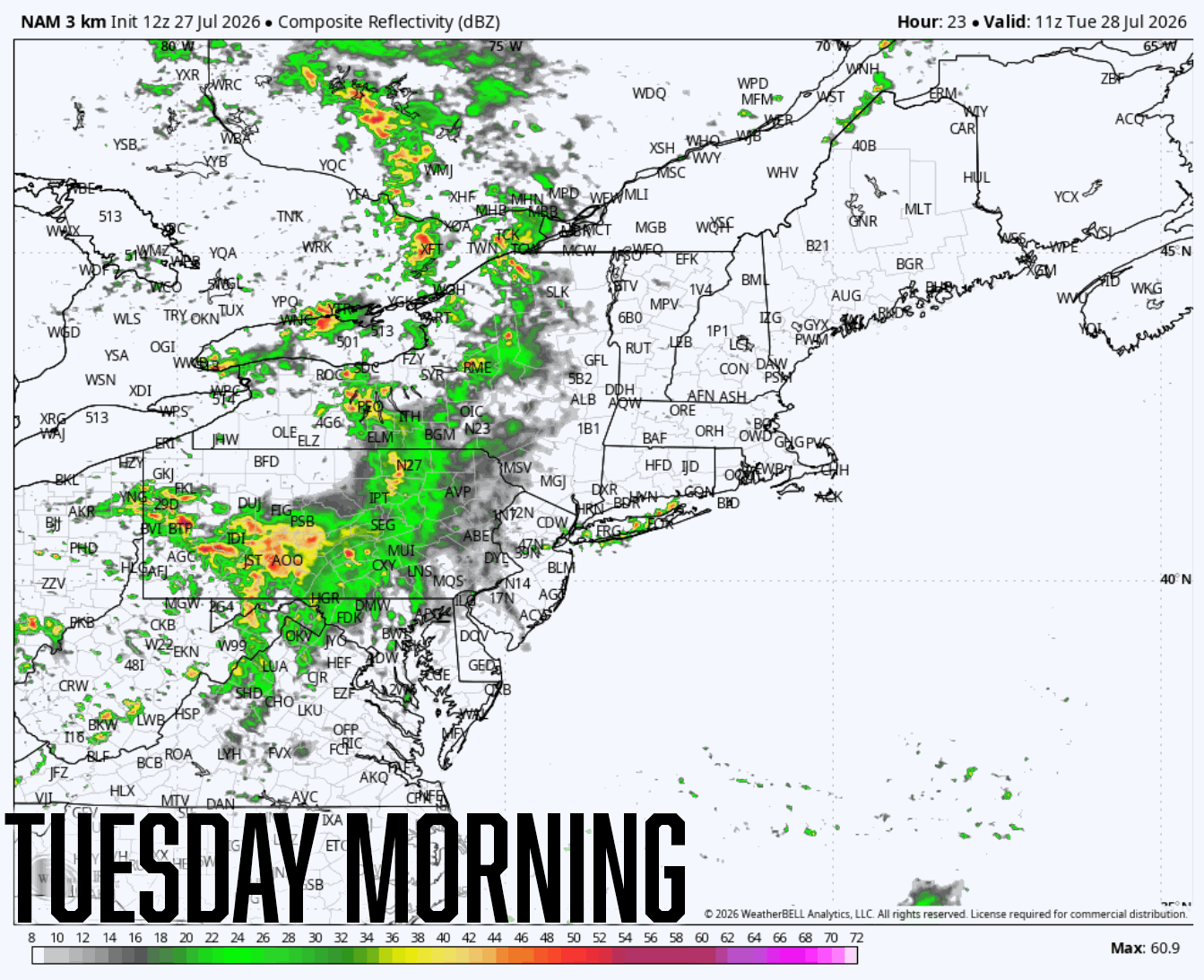
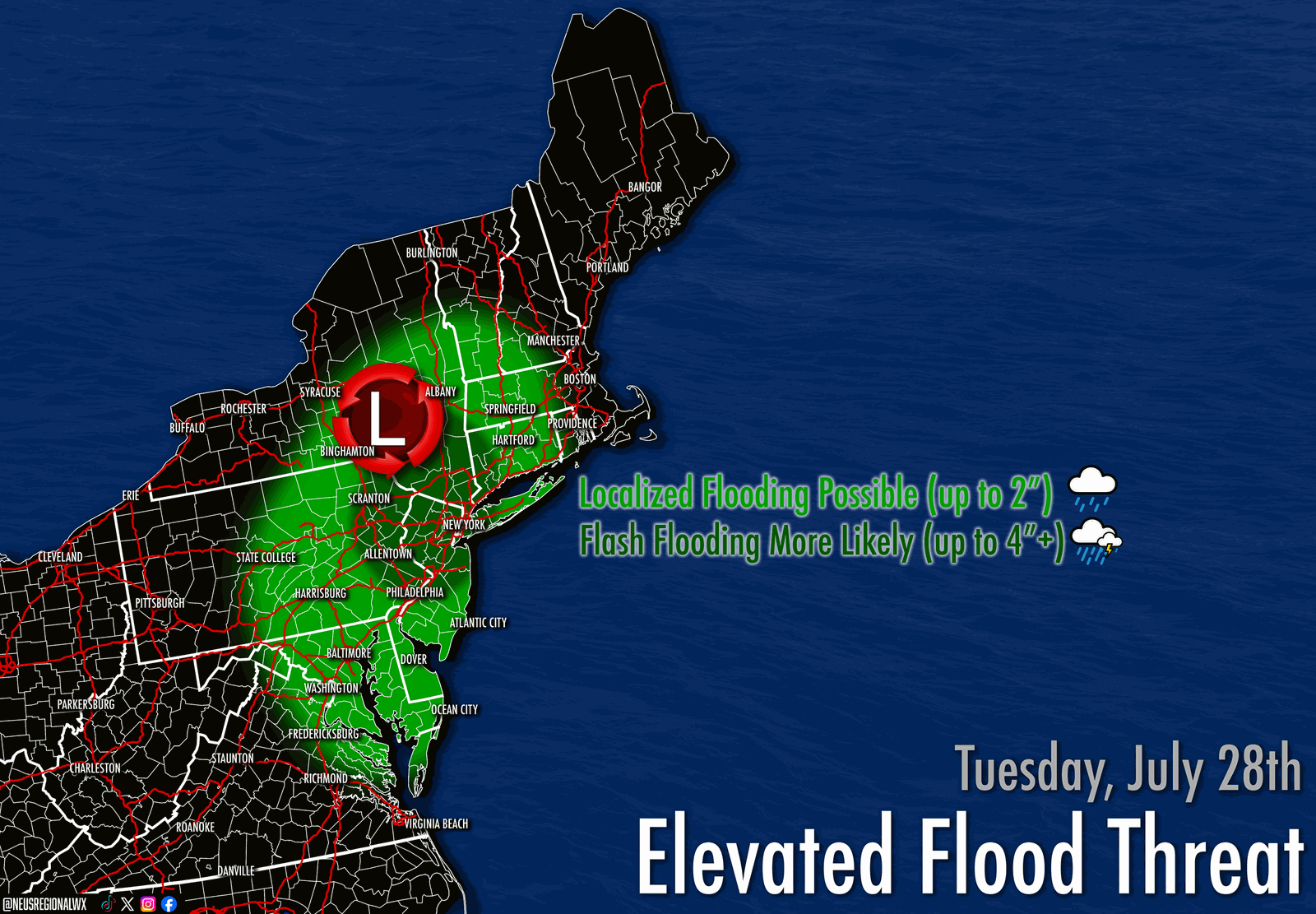
These thunderstorms will be capable of producing heavy downpours with very heavy rainfall rates, which could produce flash flooding in a very short amount of time, especially in areas that have received an abundance of rainfall over the last two weeks, notably in and around Southeastern Pennsylvania, but this threat extends beyond this area. From Southeastern Pennsylvania into Delaware, New Jersey, and the New York City metro, flash flooding will be a threat Tuesday afternoon and evening, especially under any training thunderstorms, which may produce rainfall totals in excess of 4" in a short period of time.
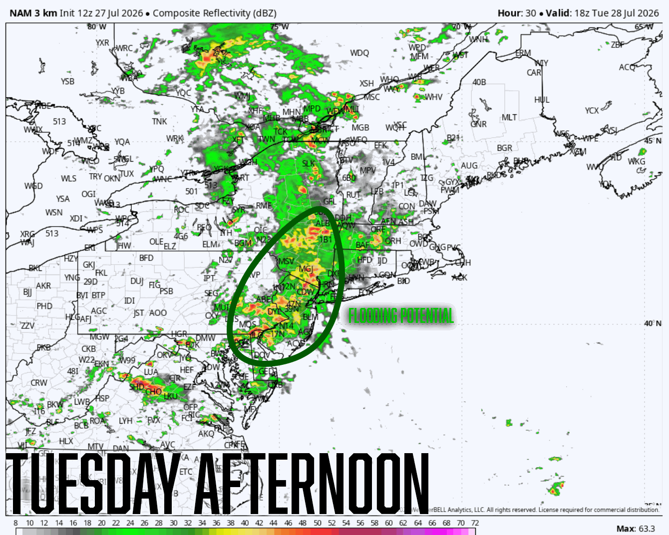
Alongside the flood threat tomorrow, which is the main concern, sufficient instability with moderate CAPE values and lapse rates could produce strong to severe thunderstorms south of the Mason Dixon Line, particularly across Virginia and the Delmarva. Isolated damaging wind gusts (up to 60mph), heavy downpours, and frequent lightning are the main concerns with this risk, although an isolated weak tornado cannot be ruled out.
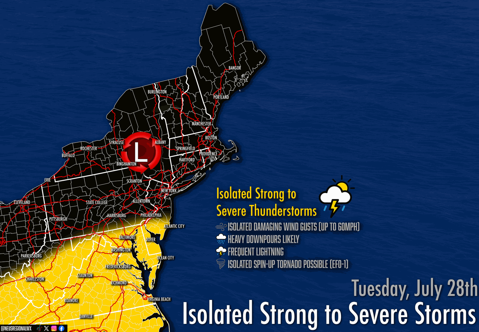
The severe threat concludes after sunset for much of the Lower Mid-Atlantic, but the flood threat over the Upper Mid-Atlantic likely continues overnight Tuesday into Wednesday, extending into Southern New England.